File:Wfm area 51 landsat geocover 2000.jpg
Jump to navigation
Jump to search
Size of this preview: 475 × 599 pixels. Other resolutions: 190 × 240 pixels | 381 × 480 pixels | 752 × 948 pixels.
Original file (752 × 948 pixels, file size: 383 KB, MIME type: image/jpeg)
| Description |
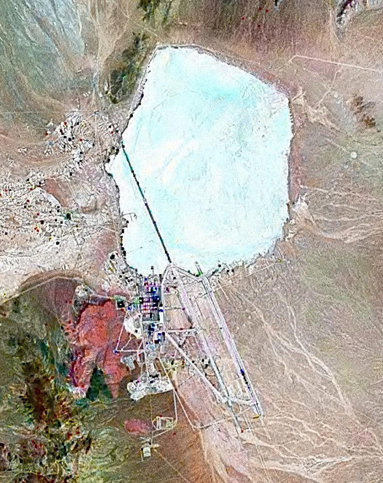
English: Landsat GeoCover 2000 pseudocolour imagery of Area 51 at Groom Lake, Nevada Test and Training Range, Nevada, USA
|
||||
| Date | circa 2000 | ||||
| Source | NASA Landsat | ||||
| Author | NASA | ||||
| Permission (Reusing this file) |
|

File history
Click on a date/time to view the file as it appeared at that time.
| Date/Time | Thumbnail | Dimensions | User | Comment | |
|---|---|---|---|---|---|
| current | 13:42, 18 February 2010 | | 752 × 948 (383 KB) | wikimediacommons>Finlay McWalter | rv, that's not a landsat image; it looks very much like a copyright GeoEye/Google Earth image, which is inelligible for use on Commons. If you diagree, upload the image under another name, don't contaminate this one with false information |
File usage
There are no pages that use this file.